This harsh winter has kept me indoors more that I care to be, but,BUT ....I got to watch "Wagon Train", WOW, double WOW. Now I want to see the Oregon Trail.
Had to share this, my inner kid is psyched!
Places to See Oregon Trail Ruts

Photo/NPS
The Oregon and California trails provided pathways to the Pacific for
fur traders, gold seekers, missionaries, and emigrants. From 1841 to
1861, more than 300,000 emigrants followed this route from the Midwest
to fertile Oregon farmlands or California gold fields—trips that took
five months to complete.
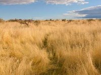
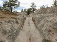
Over the years, thousands of wagon wheels and hooves churned the earth
as they traveled west. Covered wagons struggled up hills in the mud left
behind by torrential summer downpours. Emigrants fought to slow oxen
down steep hillsides as they dug their hooves in to break. All of this
activity left a discernable trail in the hard rock and a wider swale in
softer soil. Though the wagon trains didn't all follow the same route,
sometimes using cutoffs, the evidence of the tremendous amount of
westward travelers can still be seen today.
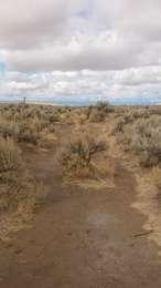
Their traces are often referred to as wagon ruts and
they can appear a variety of ways depending on the type of soil and the
continued effects of water erosion. In some places, the ruts might look
like a very obvious ditch, and in others they might be a wider,
shallower, drainage.
One of the best ways to experience the Oregon Trail is by taking a step
back in time while visiting a trail rut. Luckily, there are still places
where you can have that experience today. Take a look at the the list
below and plan your visit to the mid-1800s today!
These trail sites are working hard to protect these important
historical resources. Please remember to treat these special trail
resources carefully and with respect when you visit.
Please contact each site before you go to obtain current information on closures, changes in hours, and fees.
Oregon
Showing results 1-2 of 2
- Oregon National Historic Trail
Echo Meadows
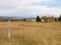
The primary route of the Oregon Trail passed through Echo Meadows from 1847-1860. Just four miles from the Umatilla River crossing, emigrants did not stop or camp here, but they left signs of their passing nonetheless. Deep wagon swales were created as the emigrants passed through the meadows, which remain to this day.
- Oregon National Historic Trail
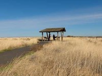
National Historic Oregon Trail Center- Trail Ruts
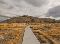
The National Historic Oregon Trail Interpretive Center is located at the top of Flagstaff Hill. The Oregon Trail reached this hill by going through the small valley, known as Virtue Flat, that lies just south of the center. Traveling through this valley was no easy task. Emigrants had to fight their way through shoulder-tall sagebrush just after spending four or five difficult days ascending Burnt River. The trek across Virtue F
Idaho
Showing results 1-3 of 3
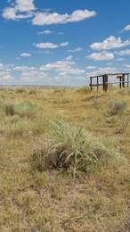
Oregon Trail Park and Marina contains a short segment of original Oregon Trail wagon swales. The Trail, marked by white carsonite markers, heads up from the park's lake, Alexander Reservoir, and crosses the park's entrance road. Look for the swales in the grass on either side of the entrance road near its junction with U.S. 30.
Remnants of the Oregon and California Trails can be found by continuing on the trail at Massacre Rocks Rest Area to the historical site . To reach this site, walk past the Snake River overlook and through the tunnel that goes underneath both lanes of the interstate highway. When you exit the tunnel, follow the trail to right. It will take you first to a series of interpretive wayside exhibits on Oregon Trail history.
- Oregon National Historic Trail
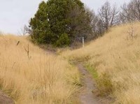
Milner Historic Recreation Area Swales
The Oregon Trail ruts at Milner Historic Recreation Area cut across the loop road here in a couple of places. The shallow trough-like swale can be seen extending on both sides of the road through the grassy landscape dotted with sagebrush. Small white posts labeled "Oregon Trail" mark the position of the swale.
Wyoming
Showing results 1-4 of 4
The Bedlam Ruts are a fine stretch of Oregon Trail ruts and swales that visitors can walk. This Trail segment is on 40 acres of undeveloped public lands jointly managed by the Bureau of Land Management and the National Park Service (Ft. Laramie National Historic Site).
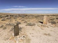
Independence Rock was the most-noted landmark of the wagon trails west of Fort Laramie. The rock derived its name from a party of fur trappers who camped and celebrated Independence Day near the rock on July 4, 1830. Eventually, thousands of emigrants camped at the foot of this 1,900 feet long by 850 feet wide granite outcrop. They carved their names and messages into the granite, using Independence Rock as a bulletin board for Oregon Trail.
South Pass , a 20 mile wide, gently sloping gap in the Rocky Mountains, was perhaps the most important landform along the emigrant trails. It opened the West to settlement by providing a route over the Continental Divide that wagons could negotiate. Everyone who followed the Oregon Trail through Wyoming used this sagebrush and grass covered saddle. A wide and deep path was created as thousands of wagon wheels and livestock hooves steadily eroded the ground.
- Oregon National Historic Trail
Oregon Trail Ruts State Historic Site
Oregon Trail Ruts State Historic Site , also called the Guernsey Ruts, is located where the geography of the area forced the Oregon Trail to change course. At this point, the Trail was blocked from continuing along the North Platte River by a steep ridge of sandstone rock. It had to go up and over the ridge in order to continue heading west.
